
Sydney’s GreenWay Trail is open: A Major Step for Active Transport and Urban Green Space
How 20+ years of community advocacy turned a stormwater drain and maintenance track into a much-loved green link in the heart of the city.
Author and photo credit: Louise Popowitz, Better Streets Board Member
Sydney’s GreenWay trail has officially opened, delivering a transformative 6 km walking and cycling corridor through the Inner West. The GreenWay trail links the Cooks River at Earlwood in the south with Iron Cove and the Bay Run in the north. Unfamiliar with this part of Sydney? You can explore the location here.
Following Hawthorne Canal, as well as the L1 Dulwich Hill light rail, the GreenWay provides a safe, accessible and enjoyable route for people walking, cycling, or using mobility devices, connecting communities across Dulwich Hill, Summer Hill, Lewisham, Leichhardt and Lilyfield.
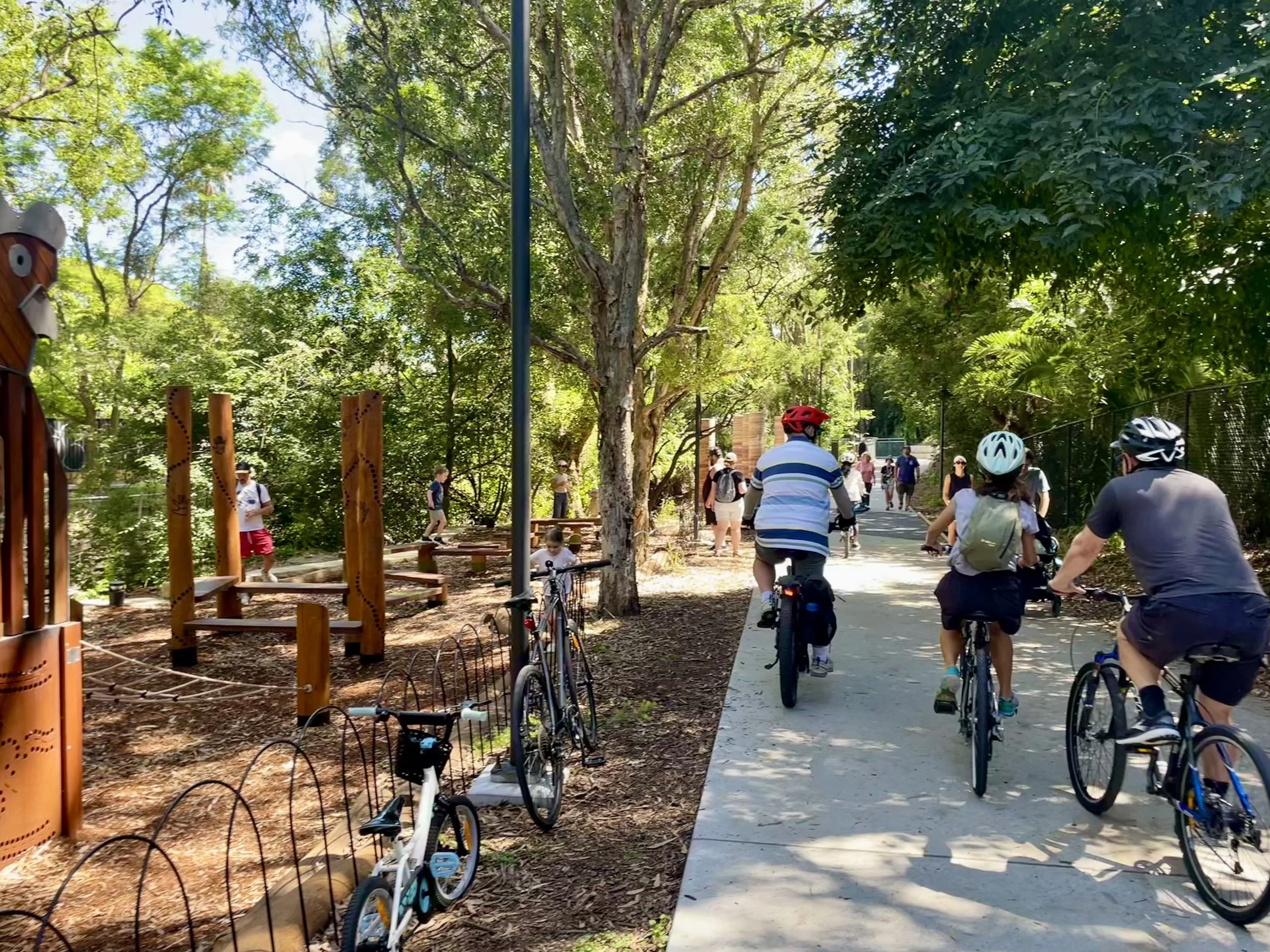
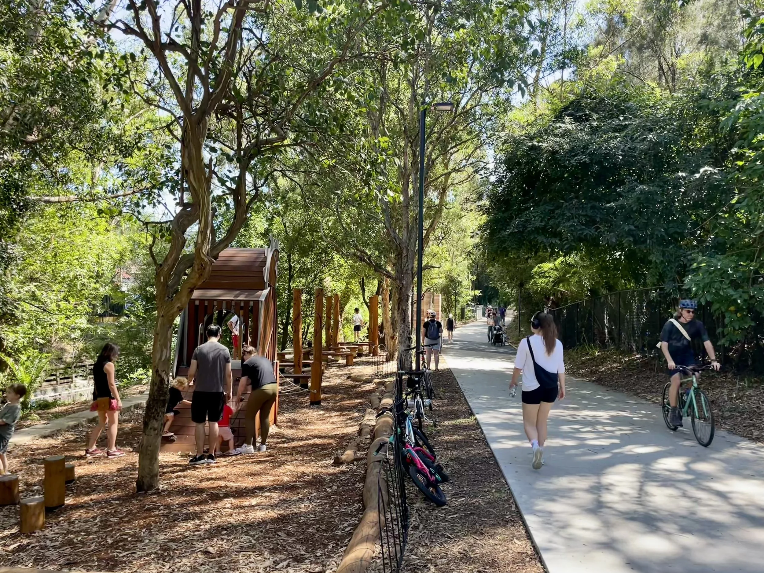
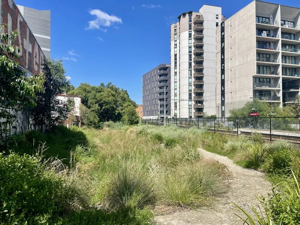
Beyond its role as a key regional green transport link within the Sydney Green Grid, the GreenWay also functions as a linear park and biodiversity corridor, with public art, restored landscapes, playgrounds and inviting places to pause and explore. While coffee stops currently require a short detour, we suspect that with time, a few cafes and coffee carts will emerge along the route.
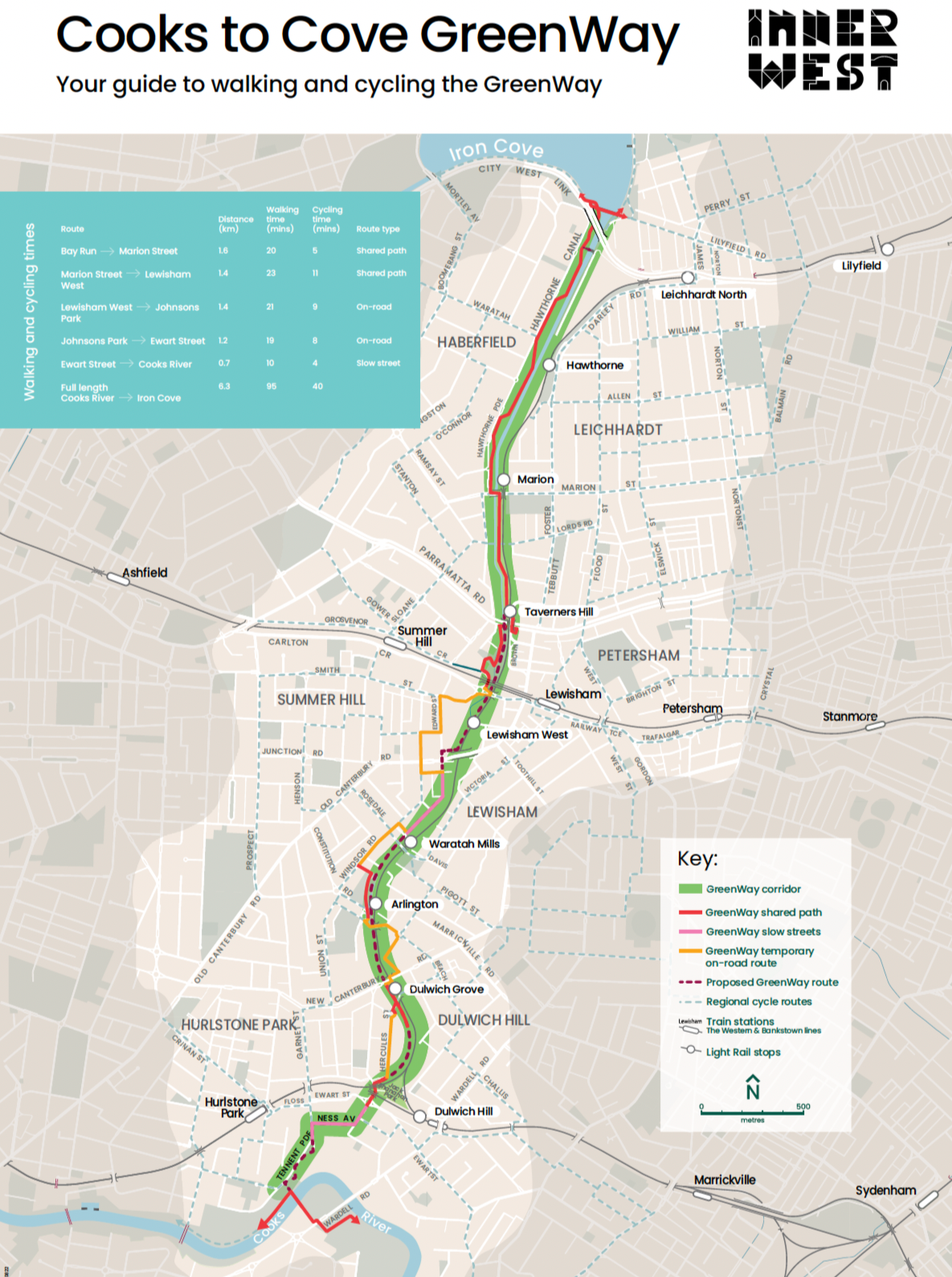
Cooks to Cove GreenWay map - Your guide to walking and cycling the GreenWay. Source: Inner West Council
Seamless and safe connections
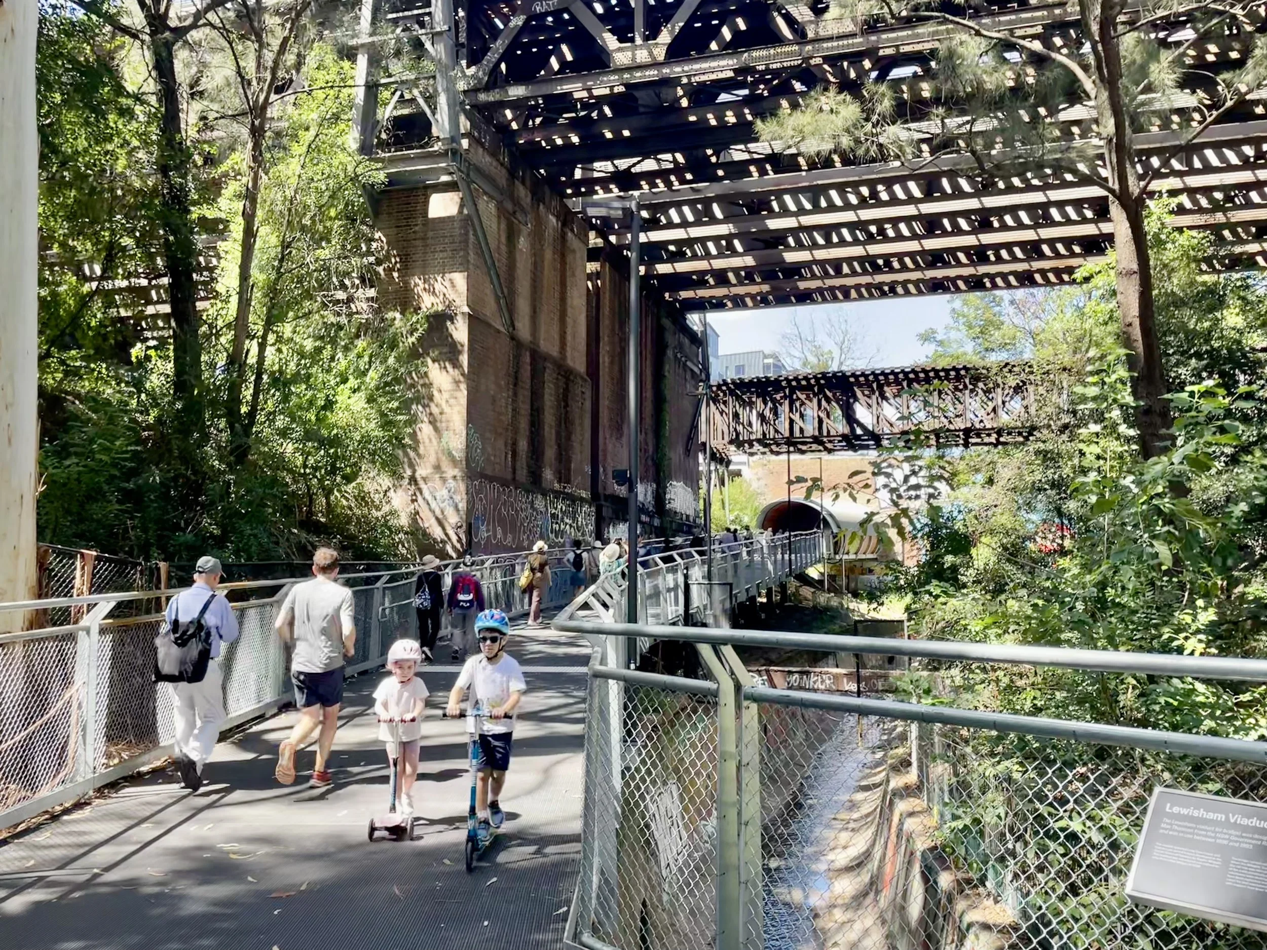
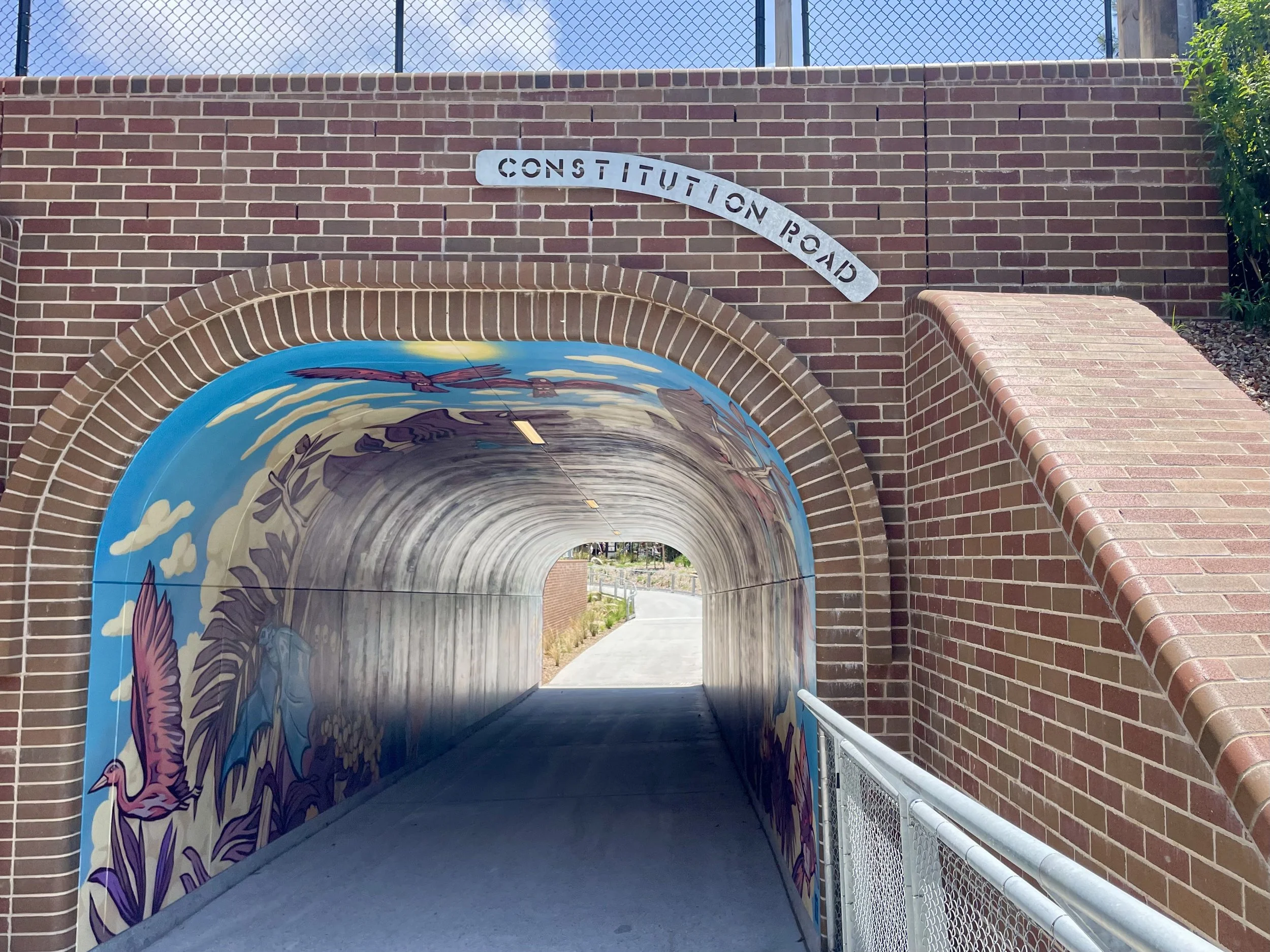
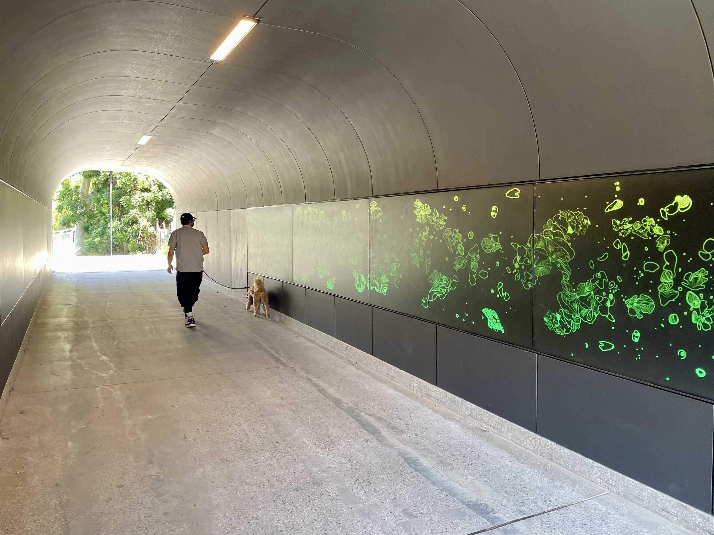
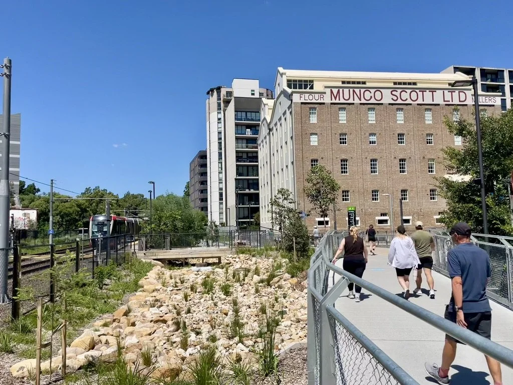
A series of new, light-filled underpasses and tunnels bypass major roads, creating a seamless and inclusive experience for people of all ages and abilities. With road crossings (at traffic signals) required only at Marion Street and Old Canterbury Road, the journey feels largely uninterrupted. Were it not for the overhead pipework of the Parramatta Road underpass, one might hardly notice that the GreenWay also passes beneath one of Sydney’s major arterial, noisy and polluted roads.
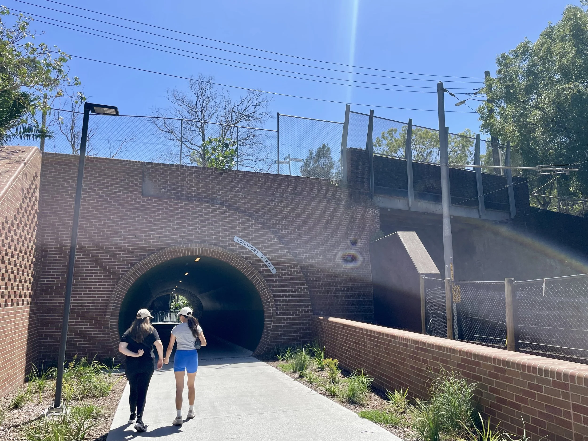
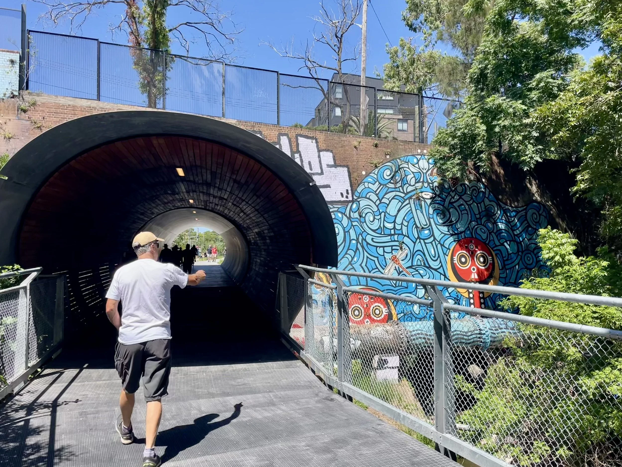
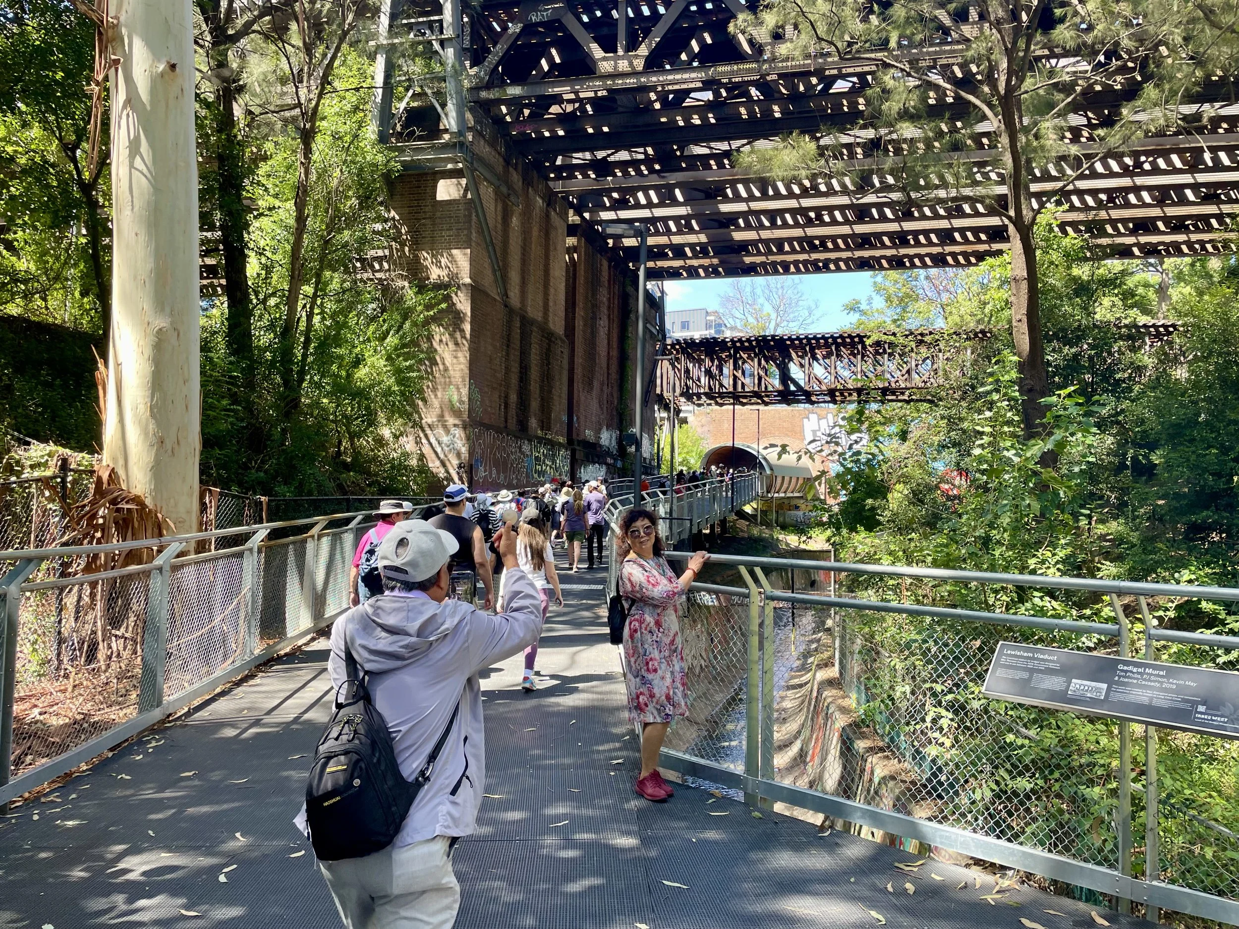
One section that is impossible to miss, and a highlight along the trail, is the stretch through Gadigal Reserve. Here, shadows and filtered light, cast first by vegetation, then as the path passes beneath the Parramatta railway line and the historic iron Whipple truss bridge from 1886, create a spectacular and atmospheric underpass.
A vital connection and celebration of Country
Before being turned into a stormwater drainage channel a century ago, Hawthorne Canal was known as Long Cove Creek, and sustained a rich ecosystem of fresh water and shellfish for tens of thousands of years. The creek formed part of the boundary between Gadigal and Wangal Country, with parts traditionally known as Djarrawunang (Magpie). Artwork and native vegetation embedded into the design of the GreenWay, offers an opportunity to recognise and celebrate this deep, continuing connection to Country.
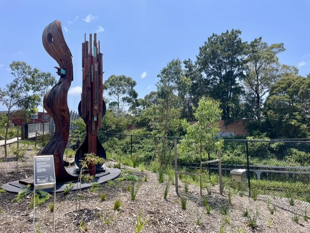
Hourglass Tree by Mark O'Ryan. Made of recycled ironbark wood from buildings of the inner west, this work stands where a turpentine ironbark forest once stood. Vestiges of nature remain in these building materials and this work attempts to recognises its presence, prompting us to consider our origins in nature. Source: Inner West Council. L Popowitz
20 years in the making - From advocacy vision to reality
Environmental and active transport planner Bruce Ashley first conceived the idea for the Cooks to Cove GreenWay in the late 1990s after walking beside Hawthorne Canal and imagining how existing paths, creeklines and a disused goods line corridor could be stitched together into a continuous green corridor linking the Cooks River and Sydney Harbour.
For more than two decades, he championed this vision, often working pro bono with community groups and councils to ensure urban ecology, revegetation and public access remained central to the project. This early commitment was later boosted by professionals engaged by Councils and has been carried forward by bushcare volunteers and local groups, whose ongoing planting and care are strengthening community stewardship of this new public asset. The finished GreenWay trail stands as a testament to persistence and to what broader and sustained community advocacy can achieve.
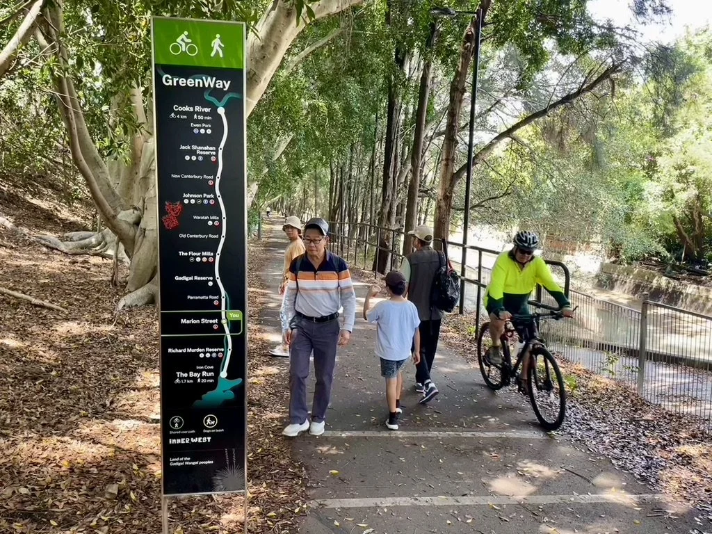
Signage along the GreenWay clearly indicates where along the trail you are. L Popowitz
Speaking with Bruce about the 20-plus-year process and challenges the project faced along the way, it is no surprise that when asked what he would change, if he were to do it all over again, the answer is "the bureaucracy". However, as he also notes, with a good overall vision and brand, it is easier to convince people to support the project, even if their interests or reasonings aren’t fully aligned with yours. From there the key is to identify the essential parts to achieve the vision; for the GreenWay that was by connecting the existing paths via rail and road underpasses and having a multi-facetted corridor.
Johnson Park with playground and outdoor gym facilities. L Popowitz
The importance of a clear management plan
Looking at the GreenWay as it stands today, Bruce is impressed by the quality of the build, and genuinely surprised at the popularity of the corridor and its use, which spill into the surrounding suburbs. But, as he notes whilst pulling out some of the weeds along the pathway, it will require ongoing maintenance and adaptation of the path and vegetation.
Due to the overlap of state and local agency assets, including Transport for NSW and Sydney Water, the challenge is for them to work together and not in isolation. This especially becomes clear when managing the weeds to protect the biodiversity and ensuring the water sensitive urban design is maintained in order to prevent flooding of the light rail and GreenWay infrastructure. With a vision to make the corridor “weed free by 33” for now, Bruce and local bushcare community groups have taken this responsibilty upon themselves.
Water sensitive urban design near Lewisham West light rail stop. L Popowitz
When asked about an especially memorable part of the process, Bruce shares the story of how the vegetation on the western side of the Lewisham West light rail stop, was home to a couple of Fairy Wrens. During the recent construction of the GreenWay, the vegetation was due to be cleared, thereby destroying the birds’ home. Therefore vegetation clearance was put on hold whilst the wetland and vegetation on the eastern side of the rail was rehabilitated in the hope that the Fairy Wrens would relocate there - the mission was a success.
Rehabilitated wetland near Lewisham West light rail stop. L Popowitz
From infrastructure to place-making
For everyday commuters as well as families and recreational users, the GreenWay trail offers a pleasant alternative to car travel, reducing traffic, supporting healthier lifestyles and enhancing connection between neighbourhoods. It shows what’s possible when cities invest in people-centred infrastructure that prioritises walking, cycling, place-making and green space.
Better Streets congratulates Inner West Council, state and federal partners, designers, builders and especially the advocates whose sustained efforts helped bring this vision to life. The GreenWay is a significant achievement, and a reminder that safer, greener and more connected streets improve everyday life for everyone.
How to get there
For active transport access, use Google maps to identify walking and cycling access
For public transport access, check out Transport NSW
Light rail: L1 runs the length of the corridor with stops at Lilyfield, Hawthorne, Taverners Hill, Lewisham West and Dulwich Hill
Train: Dulwich Hill station (T3 Bankstown Line) connects to the southern end; the Sydney Metro extension is expected to meet the GreenWay by the end of 2026
Buses: Numerous services along New Canterbury, Old Canterbury and Parramatta roads
Car: Limited street parking at James Street in Lilyfield, around Marion Street in Leichhardt, near Johnson Park and Keith Street in Dulwich Hill
For more information
Inner West Council
NSW Department of Planning, Housing and Infrastructure
https://www.planning.nsw.gov.au/government-architect-nsw/case-studies/the-greenway
Do you want to hear more about how the GreenWay trail went from vision to reality?
Sign up for our Newsletter to be the first to hear of our upcoming GreenWay event.
All photographs in this post are the property of Louise Popowitz and cannot be used, reproduced, or distributed without written consent.